In step 2 you select the data you want to apply for by drawing an area on the map and by using the options in the menu “Select data”. To view the selected data in tabular form, use the “Show selection” button. You can adjust your selection in this table.
Select data
Select the data you wish to order by clicking the top right button in the map window. The models are available per province, water board (ArcGIS files) or map sheet (basic files of the separately available Subsurface viewer). Click the triangle to expand or collapse the menu. First, the menu asks you to choose the type of data from the selected model you wish to order. Click the rectangular button to mark your area of interest on the map. All files of the selected types of data (province, water board or map sheet) that are within your area of interest are included in the selection list.
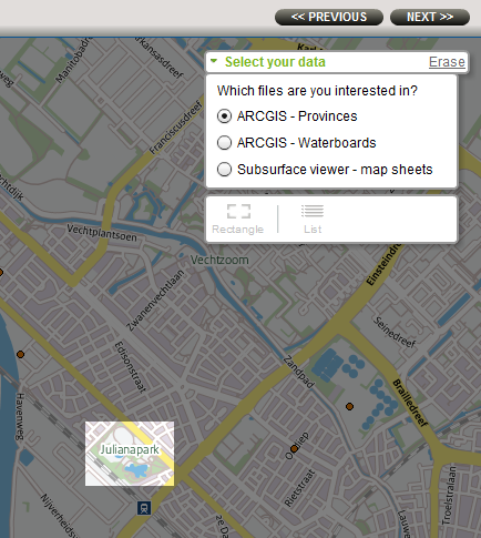
Select the file type you want to order. Then draw a rectangle to specify the area of your interest.
Show selected files button
Click the “list” button in the “Select data” menu to bring up a table with information about the selected objects. All objects within the selection area are ticked. To remove an object from your order, untick it.
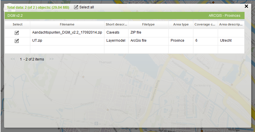
Tabular view of the available files(partly) overlapping within your area of interest.
To the next step
Once you have selected at least one object, continue to step 3 by clicking VOLGENDE >>. You can then start to order the selected objects.