The Digital Geological Model DGM is used as the basis for the regional hydrogeological model REGIS II, serving as the starting point for further subdivision of the modelled geological units into hydrogeological units, aquifers and aquitards. Using the lithological information from boreholes and additional hydrological data such as hydraulic heads and pumping tests, the hydrogeological units are characterised in terms of their hydraulic conductivity, transmissivity and vertical resistivity, vertical flow resistance. To ensure consistency between the geological and hydrogeological models, the hydrogeological units are constrained within the units of DGM. The depths to the top and the base, and the thickness of the units have been mapped in grid files at 100 x 100 metres resolution.
More detailed information about the development of the model is described in the report Totstandkomingsrapport Hydrogeologisch Model (REGIS II) (PDF in Dutch - 4.1MB). The Totstandkomingsrapport Kleine Release REGIS II onzekerheden geometrie (PDF in Dutch, 78 MB) describes how the uncertainties of the geometry of the mapped water resistant model units are calculated and the report Totstandkomingsrapport Kleine Release REGIS II v2r2s2 (PDF in Dutch 0.9 MB) describes the improvements made based on reports of two 'BRO Terugmeldingen' (the report "Inconsistency 'Formation of Oosterhout', duplication between 'Oosterhout sand 1' (OOz1) and 'Oosterhout complex' (OOc)” and the report “Error allocation 'Kreftenheye sand 4' (KRz4) and 'Kreftenheye sand 5' (KRz5) in combination with in the appearance of the 'Formation of Beegden”. In 2025, the naming (coding) of the hydrogeological units was adjusted, see the explanation accompanying REGIS II v2.2.3 (PDF in Dutch – 2.7MB).
Source data
REGIS II is based on the same set of research boreholes used for the Digital Geological Model (DGM) and has the same coverage and depth (up to 500 m) as DGM.
Application and reliability of the model results
With REGIS II, the Geological Survey of the Netherlands - TNO offers national and regional authorities, water management organisations, consultancies and other parties online and free access to the hydrogeological subsurface model of the Netherlands. As such, REGIS II is an adequate subsurface dataset for national and regional scale groundwater models. In combination with information from additional borehole research, REGIS II also serves as a basis for local groundwater models.
More details about the quality of the model can be found in the documents Kwaliteitstoetsingsdocumenten Hydrogeologisch Model (REGIS II) (ZIP in Dutch - 82 MB).
Current and earlier versions
The current version available is REGIS II v2.2.3 (2025). It is based on DGM v2.2 and compatible with DGM v2.2.1. Earlier versions of the REGIS II model can be requested via the contact form.
Citation
TNO – GDN (2025) BRO REGIS II v2.2.3. TNO - Geological Survey of the Netherlands, https://www.dinoloket.nl/en/subsurface-models/map; visited yyyy-mm-dd.
Reports
A list with reports on this model is available on the Report back page.
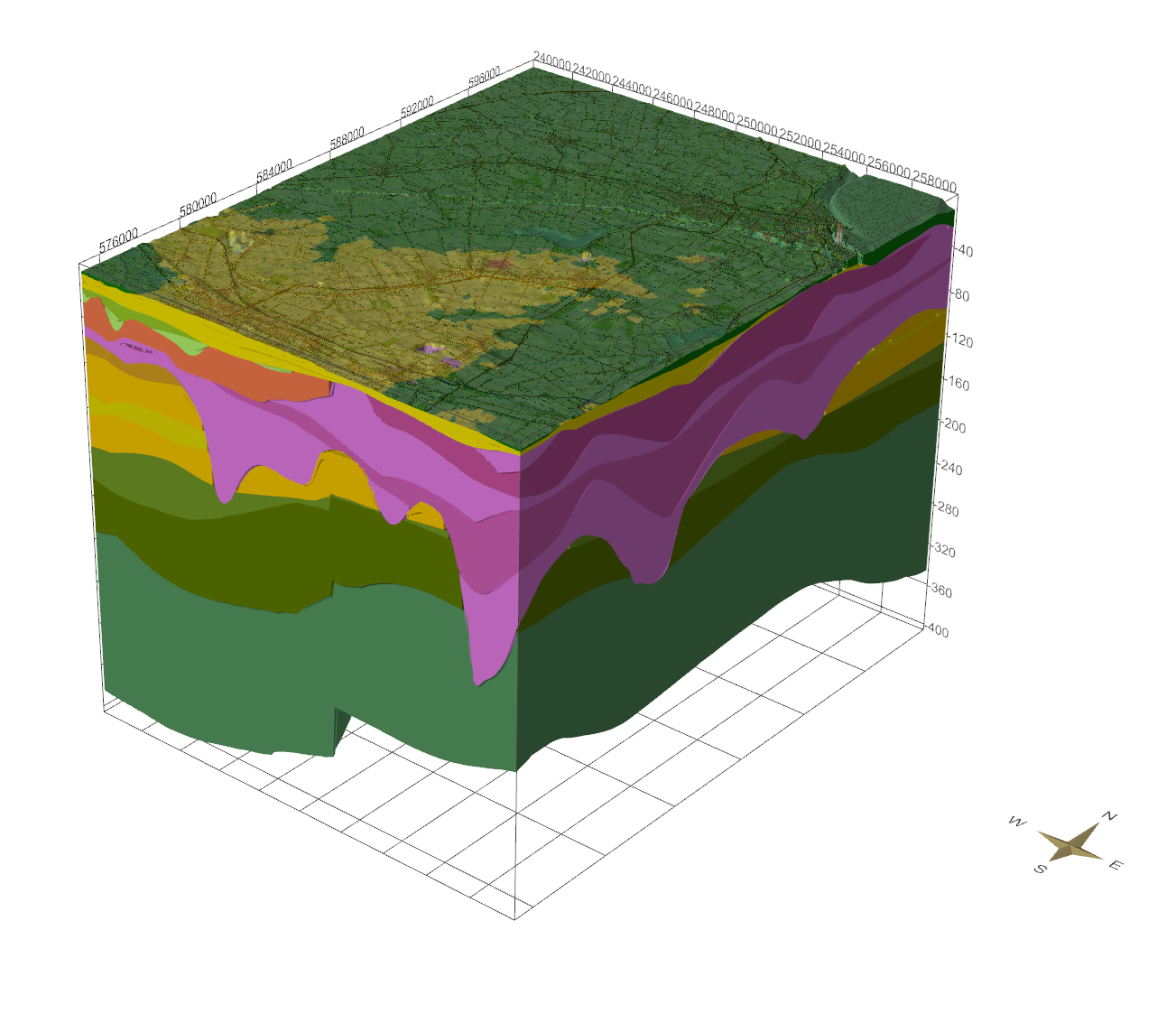
3D representation of Oost-Groningen in REGIS II using the SubsurfaceViewer