By drawing a line on the map - for example along a dike - a cross-section of the models can be visualised showing the vertical sequence of layers or voxels. These cross sections can help you to explore the 3D structure of the models.
For the GeoTOP model the cross section lets you select additional attributes of the model: geological unit, most probable lithological class and the probability of occurrence of the lithological classes. In the model area West Wad the model uncertainty of the geological unit or the lithological class can also be displayed.
Limitations
Faults cutting the cross-section are not displayed explicitly. In case of displacement along the fault plane the cross section shows an abrupt change in the vertical position of a model unit and/or the lithological class.
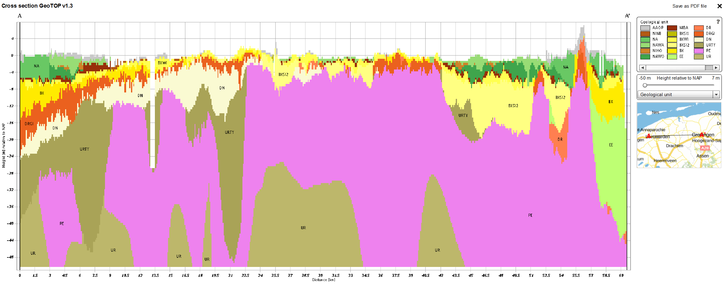
Example of a cross section through the GeoTOP model showing attributes you can select
View and save
Cross sections can be viewed and saved in Step 1.